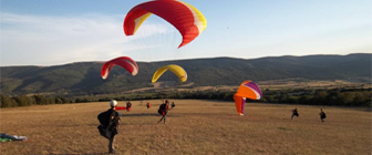
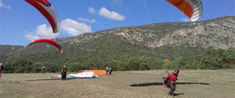
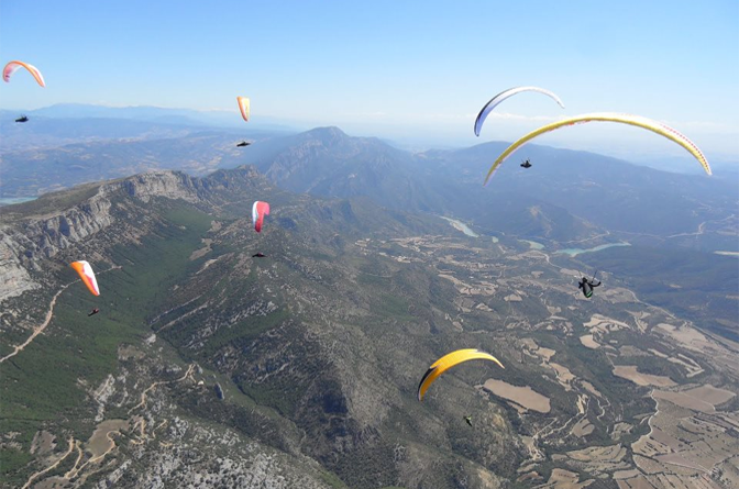
We are in an exceptional area for paragliding in Lleida.
Located in the region of the Noguera, province of Lleida, it includes the valley between the top of the Montsec (border between the counties of Noguera and Pallars Jussà) and the mountains of Port d’Ager. On the western border with Noguera Ribagorzana river and Canelles dam and east with Pallaressa Noguera river and the Camarasa dam. The maximum height of Montsec is the Pic de Sant Alis, 1678 m.
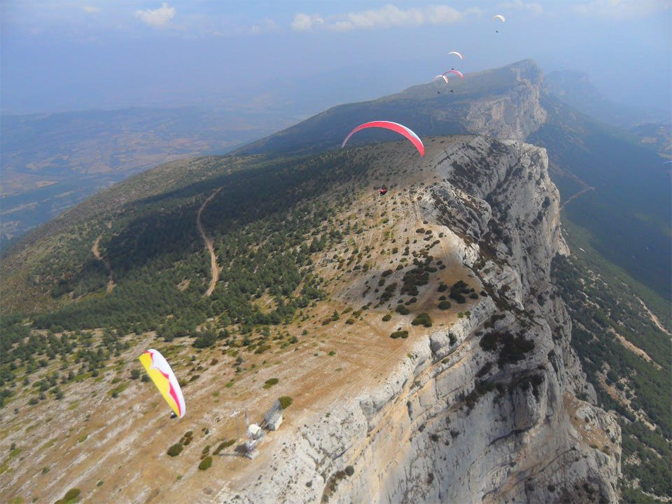
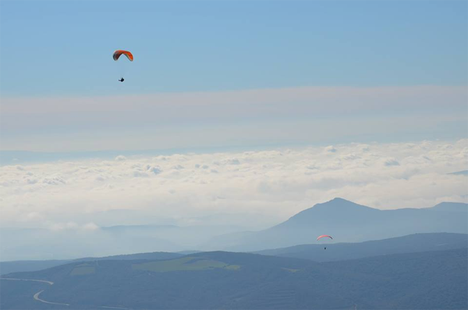
The valley has an east-west orientation and the slope of the Montsec faces towards the south, which generates fantastic possibilities for flying. The air conditions are especially favorable at noon.
There are several takeoff and landing spots prepared, and there is no problem in finding alternative landing or takeoff spots in case of needing them. The access to the takeoff zones are marked by signs on the forest track, making it easy to access them even for the first time.
With a tradition in free flying for 30 years, in the area there have been national and international championships, giving it an international projection that makes the area frequented by flyers from all around the world.
TAKEOFF SPOTS
The acess to the takeoffs is through the paved trail that begins at the west end of the town, next to the cemetery. It is perfectly drivable by all types of vehicles including cars.
RAUDORAL (LA NOVA)
Newly created, it allows you to take off without having to go to the top of Montsec. It is a clean ramp that allows to take off several paragliders at once, although the take off is done one by one. It faces the south and it is the best takeoff when we have strong winds. With eastward winds its use is not recommended. Slope to the camping landing: 500m. To Camp T: 450m. GPS: 31T 312693, 4656422
GABRIELÓ (TABLONES)
It is a takeoff spot with a wide space to deploy paragliders and their wings. The take off is done in a single spot, and we have to keep monitoring the three indicator beams as there can be difficult conditions in which the wind can play tricks on us. Its orientation is southward. You should avoid taking off from this spot with West winds. It is a good takeoff spot when the Northward wind prevents taking off from the top. Slope to the Camping landing: 550m. To Camp T: 500m. GPS: 31T 315102, 4655761
COLL D’ARES (ROPER)
It is a broad and clear takeoff spot. It has space for a lot of flyers to get ready at once, with a usable takeoff zone of more than 50m. It has a few beams to control the wind. Its orientation is Southward, allowing the takeoff with crosswind coming from the West. If there are a lot of strong winds from the west, it is slightly lee side, which makes it preferable to continue to the takeoff spot of Sant Alis. Slope to the Camping landing. 900m, to the field T: 850m. (50 meters ahead there is another small takeoff, called COMPETICION with a slight west orientation). GPS: 31T 313555, 4657599.
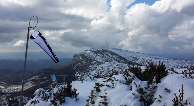
SANT ALÍS (LA PEDRA)
It offers us an incredible view: Montseny, Montserrat, Monte Caro, Sierra de Prades, Montsant, the Moncayo, Sierra de Guara and the Pyrenees from Navarra to Girona. In the most prominent part we find a ramp now obsolete, because it is an unsafe and abrupt takeoff. Just to the left it is the place where you do the takeoff without a problem. Its orientation is South East, so with wind from the West we will refrain from using it. Slope to the Camping landing: 1050m. To Camp T: 1000m. GPS: 315237, 4656809.
LANDING SPOTS
CAMP DE “PLA DE MATES” – MACIAROL
Located on the right side of the road to the Colld’Àres and 1km. and a half away from the village of Ager. It is attached to the farmhouse Cal Maciarol and has a lot of parking spots for vehicles on the access road to the field. It is a very spacious landing and the most used by our tandem pilots. GPS: 31T 313660, 465400.
CAMPING
It is located next to the Camping de la Vall d’Ager. It is accessed from the road in the middle of the town. There is an indicator. It is a rectangular field of 200 x 50 m, with east – West orientation. It has beams and its soil is mostly low grass and dirt. You should be careful with the turbulence produced by the hedge of the north side. GPS: 31T 315079, 4652814.
ALTERNATIVE LANDING (ALSO KNOWN AS CAMPO DE 300)
It is a landing spot located under the takeoff of “Coll d’Ares” with a slope of approximately 300 meters from the takeoff. It is used as an alternative if altitude is not enough to go to the second slope. GPS: 31T 313452, 4656826.
AGULLÓ LANDING
It is frequently used as hang gliding landing because of its size, and because there are no obstacles around.
It is accessed from the road from Ager to Agulló. It is a rectangular field of 300 x 300 m., with an East-West orientation, but its dimensions allow the North-South landing.
IMPORTANT: Do not use it if it’s planted. You can land in the months from July to October. GPS: 31T 311841, 4653618.